Wednesday, March 21, 2012

Igneous Rock: Peridotite

Peridotite is coarse grained and contains high content of magnesium, and is the dominant part of the Earth's upper mantle. It consists mostly of the minerals olivine and pyroxene. They can be either layered or massive, and both types can have varying textures of crystal structure. It is usually a dark green color, depending on the level of olivine comprising it.

Peridotite is usually found beneath the Earth's crust, and is rarely visible on the surface because it is so unstable when reacting with water. Types of peridotite located near the crust are usually transformed through varying processes to become other minerals, like serpentine. One type of serpentine is commonly known as asbestos.
The Smith River in California is one of the Earth's largest exposures of peridotite, at the depth of 10-50 km. 

Friday, February 10, 2012

Minerals

Feldspar
Pumice

Limestone
Calcite
Obsidian
Pumice brush
Obsidian jewelry
Galena


Wednesday, February 1, 2012

Tuesday, January 31, 2012

Different types of map projections offer efficient and accessible ways to illustrate data.


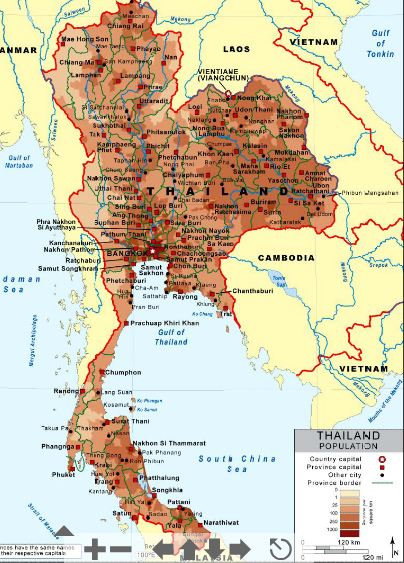
Here is an example of a choropleth map, which color codes data.
Choropleth Map of Thailand's Population


An isarithmic map uses lines to project more fluid data, like this map of the globe's varying climate temperature.                                  

Isarithmic Map of Global Climate Temp. Each Month


A proportional symbol map depicts data with sized images instead of color to illustrate varying data, such as this map, which uses coin symbols to show the number of establishments for coin-operated amusement devices in the United States.
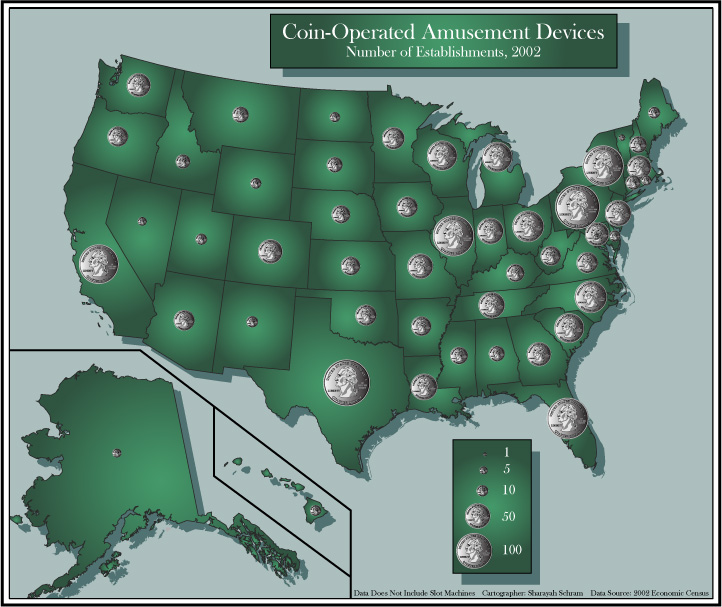
Proportional Symbol Map of Coin-Operated Amusement Devices, 2002
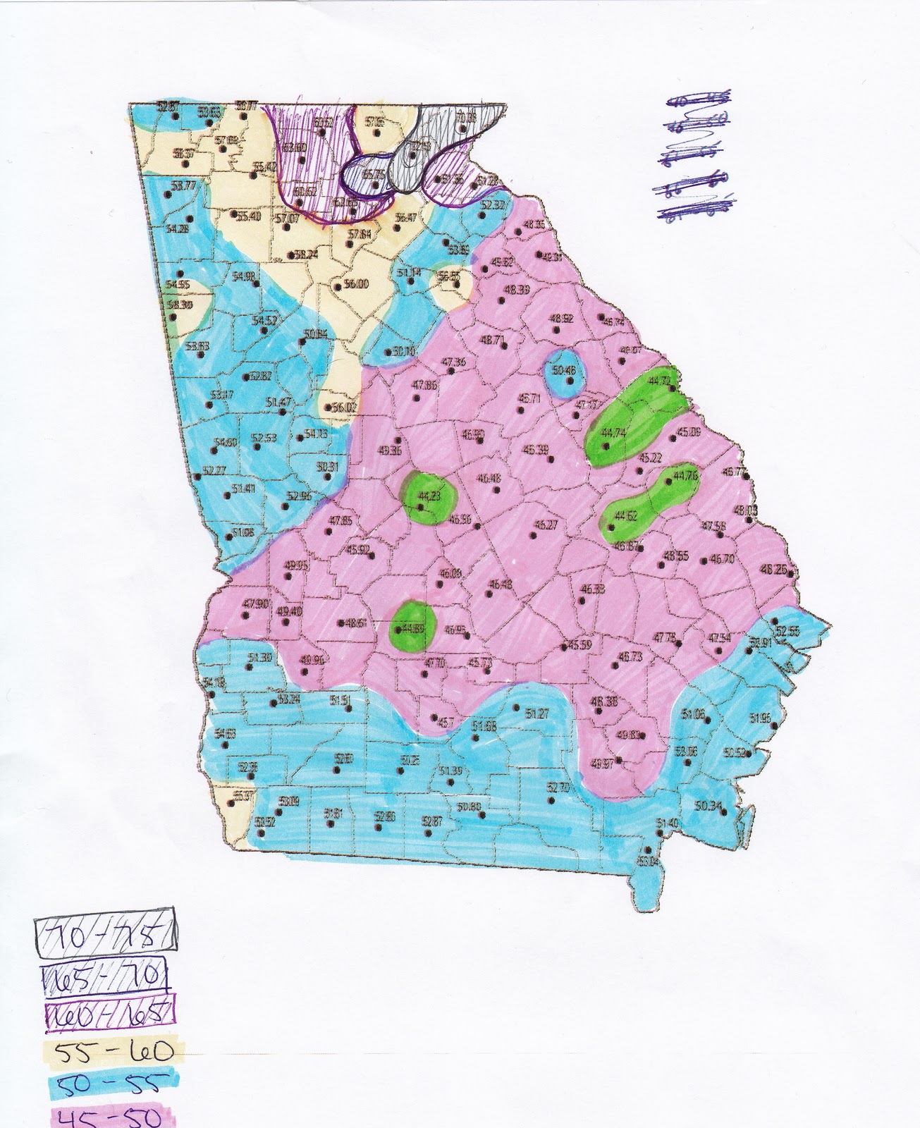
Dot density maps depict data much like proportional symbol maps, but use varying numbers of dots instead of differently sized symbols to show varying data. Below is a dot density map of Georgia's population. The red dots indicate that area's population per square mile.
Dot Density Map of Georgia, US


Thursday, January 19, 2012

Basalt Formation: Genbudo, Japan

Basalt formation in Genbudo cave


Basalt is a type of igneous, or volcanic rock which underlies most of the earth's surface. It is commonly used in construction for pavement, cobblestones, and in making statues. Its shape when hardened indicates the process and environment by which it was cooled. In the cave above, the basalt formed in polygonal shapes, but other basalt formations can be columnar when cooled more rapidly.


Learn more about basalt.